GTA 6 Trailer Locations vs Real Life (Every Miami Spot)
Every spot from the official GTA 6 trailers on one map, and the real Miami and Florida places they are based on.
Open the interactive map1. Ocean Beach (the beach flyover)Unverified
- Seen in
- Trailer 1 (Dec 2023), at 0:13
- Real-life spot
- South Beach and Lummus Park, Miami Beach
- Pin position
- Approximate until launch
Early in Trailer 1 the camera flies in over the surf and the sand toward Ocean Beach's hotels and condo towers, with the downtown skyline behind.
Show on map →Visit it in real life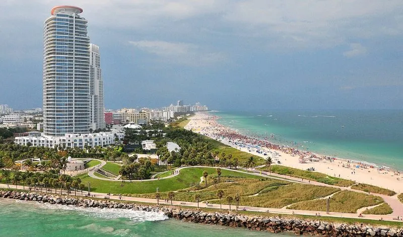
Photo: M McBey, CC BY 2.0, via Wikimedia Commons Lummus Park Beach, Ocean Dr, Miami Beach, FL 33139Drive or take a rideshare over the MacArthur Causeway to South Beach. Lummus Park beach runs alongside Ocean Drive from about 5th to 15th Street.
Best time: Morning, when the beach is quiet and the light is soft.
Open in Google Maps →2. 1500 Ocean Drive-style condosUnverified
- Seen in
- Trailer 1 (Dec 2023)
- Real-life spot
- 1500 Ocean Drive, Miami Beach
- Pin position
- Approximate until launch
A beachfront condo tower seen in the Trailer 1 opening, modelled on a real Ocean Drive building.
Show on map →Visit it in real life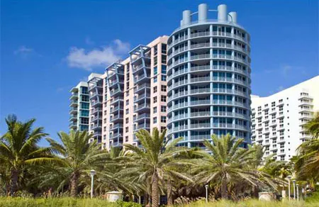
Photo: used with permission 1500 Ocean Dr, Miami Beach, FL 33139At the north end of the Ocean Drive strip, across from Lummus Park beach.
Best time: Early morning for clear photos without crowds.
Open in Google Maps →3. Loews-style beach hotelUnverified
- Seen in
- Trailer 1 (Dec 2023), opening shot
- Real-life spot
- Loews Miami Beach Hotel
- Pin position
- Approximate until launch
A big beachfront hotel in the opening shot, matching a well-known Miami Beach hotel.
Show on map →Visit it in real life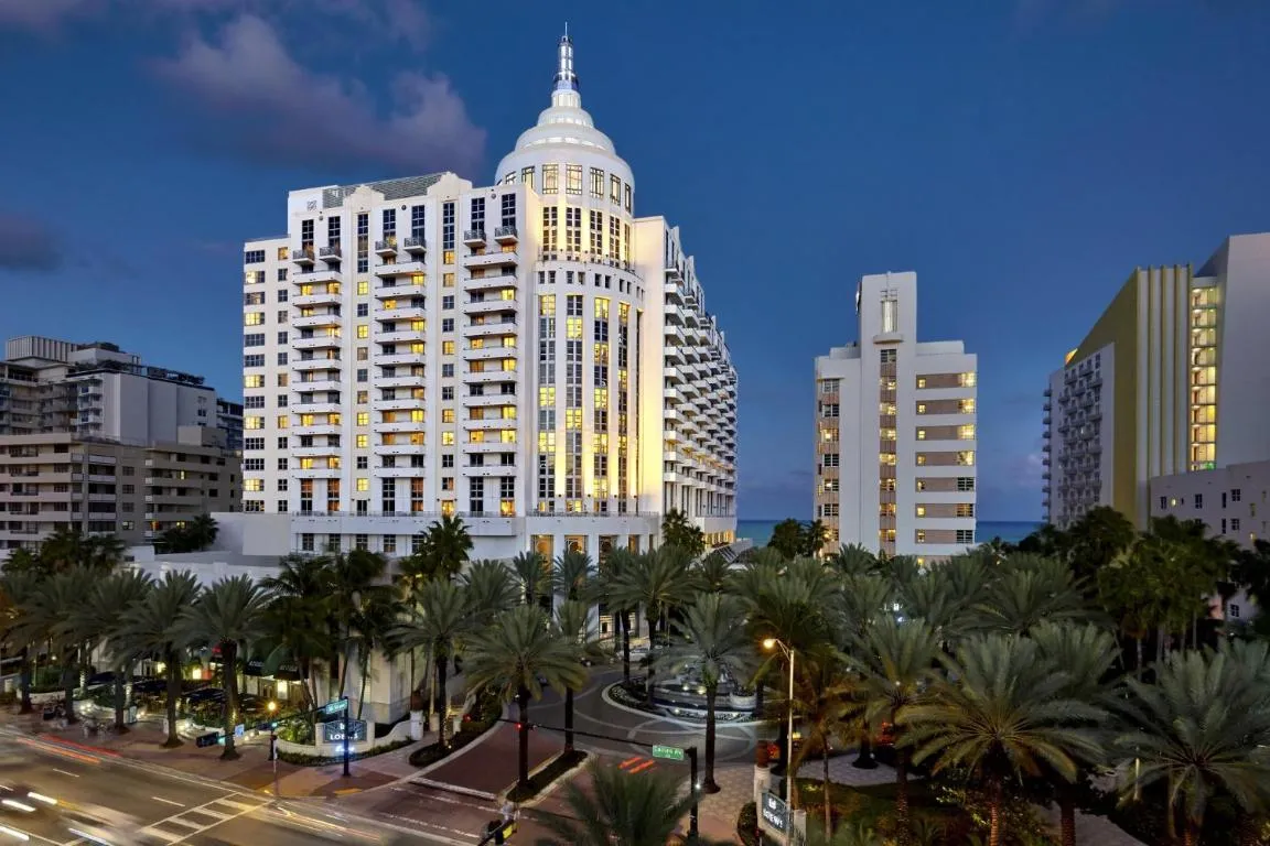
Photo: used with permission 1601 Collins Ave, Miami Beach, FL 33139One block inland from the beach, at Collins Avenue and 16th Street in South Beach.
Best time: Golden hour, from the beach side.
Open in Google Maps →4. Hotel DixonUnverified
- Seen in
- Trailer 1 (Dec 2023)
- Real-life spot
- Hotel Victor, Ocean Drive
- Pin position
- Approximate until launch
An Art Deco hotel a little further down the beach strip.
Show on map →Visit it in real life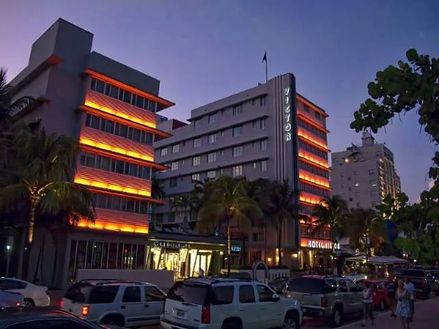
Photo: Dan Lundberg, CC BY-SA 2.0, via Wikimedia Commons 1144 Ocean Dr, Miami Beach, FL 33139On the Ocean Drive strip in South Beach (the real hotel is the Hotel Victor).
Best time: Evening, when Ocean Drive is busiest.
Open in Google Maps →5. Hotel BoardwalkUnverified
- Seen in
- Trailer 1 (Dec 2023)
- Real-life spot
- Hotel Breakwater, Ocean Drive
- Pin position
- Approximate until launch
Another Ocean Beach hotel with a classic Deco front, further south on the strip.
Show on map →Visit it in real life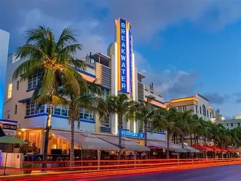
Photo: used with permission 940 Ocean Dr, Miami Beach, FL 33139On Ocean Drive in South Beach (the real hotel is the Hotel Breakwater).
Best time: At night for the neon sign.
Open in Google Maps →6. Sahara ArenaUnverified
- Seen in
- Trailer 1 (Dec 2023)
- Real-life spot
- Kaseya Center (home of the Miami Heat)
- Pin position
- Approximate until launch
Vice City's big downtown arena on the waterfront, by the causeway out to the beach.
Show on map →Visit it in real life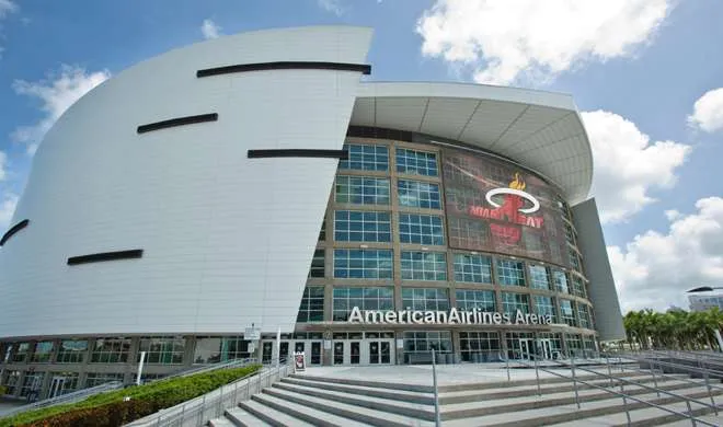
Photo: used with permission 601 Biscayne Blvd, Miami, FL 33132Downtown Miami on Biscayne Bay, next to Bayside Marketplace; the free Metromover stops nearby.
Best time: On a game or concert night.
Open in Google Maps →7. Brickell on the River-style towerUnverified
- Seen in
- Trailer 1 screenshot
- Real-life spot
- Brickell on the River, Brickell
- Pin position
- Approximate until launch
A riverside high-rise in Vice City's financial district, seen in an official screenshot.
Show on map →Visit it in real life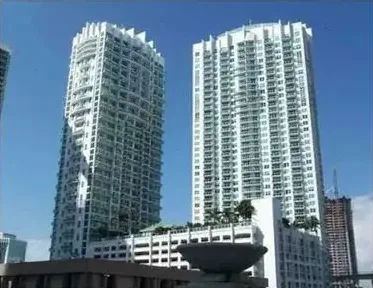
Photo: used with permission 31 SE 5th St, Miami, FL 33131In Brickell, by the Miami River; walk the Riverwalk to see it from the water's edge.
Best time: Sunset from the Riverwalk.
Open in Google Maps →8. The causeways to the beachUnverified
- Seen in
- Trailer 1 (Dec 2023)
- Real-life spot
- MacArthur and Venetian Causeways
- Pin position
- Approximate until launch
The trailer's drive from the beach to the mainland crosses long causeways over the bay, past the islands.
Show on map →Visit it in real life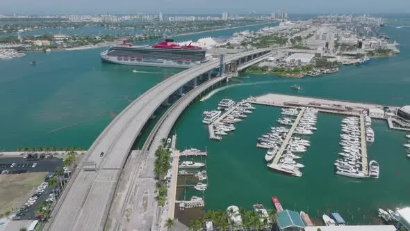
Photo: used with permission Venetian Causeway, Miami, FLThe Venetian Causeway links Biscayne Boulevard in Miami to Miami Beach; the MacArthur Causeway runs just south of it. The Venetian is popular for walking and cycling.
Best time: Sunrise or sunset, by bike or on foot.
Open in Google Maps →9. The long Keys bridgeUnverified
- Seen in
- Official trailer
- Real-life spot
- Seven Mile Bridge, Florida Keys
- Pin position
- Approximate until launch
An aerial shot of a long bridge hopping between islands in the Keys.
Show on map →Visit it in real life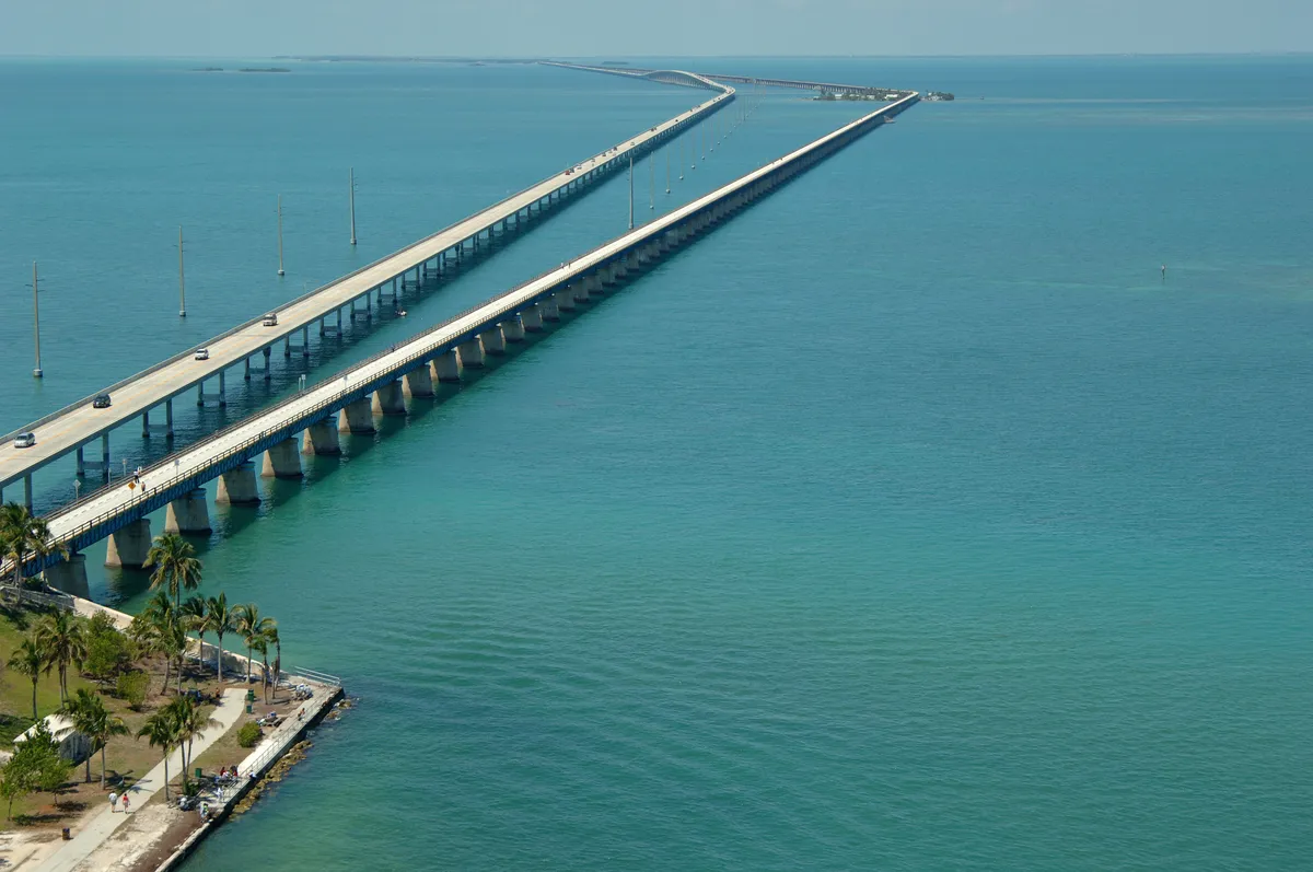
Photo: used with permission Seven Mile Bridge, Overseas Hwy (US-1), Marathon, FLDrive the Overseas Highway south from Miami to Marathon in the Florida Keys. The restored Old Seven Mile Bridge next to it is open to walkers and cyclists.
Best time: Sunset, from the old bridge.
Open in Google Maps →10. Grassrivers airboats and gatorsUnverified
- Seen in
- Trailer 1 and Trailer 2
- Real-life spot
- The Everglades
- Pin position
- Approximate until launch
Airboats racing through the wetlands, with flamingos and alligators.
Show on map →Visit it in real life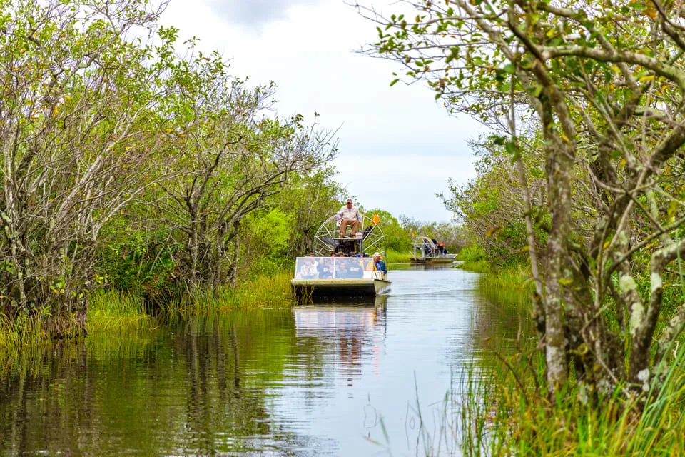
Photo: used with permission Tamiami Trail (US-41), Everglades, FLDrive west from Miami on the Tamiami Trail (US-41); airboat tours run along the edge of Everglades National Park.
Best time: December to April (dry season): more wildlife, fewer mosquitoes.
Open in Google Maps →11. Ocean View & Congress hotelsUnverified
- Name
- Seen in official Rockstar material
- Real-life twin
- Congress Hotel, Ocean Drive, Miami Beach
- Pin position
- Approximate until launch
A row of white Art Deco hotels with neon strips and tall vertical signs along the beach strip, shown in official footage.
Show on map →Visit it in real life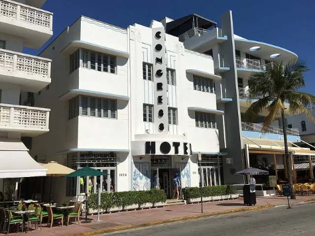
Photo: Phillip Pessar, CC BY 2.0, via Wikimedia Commons 1052 Ocean Dr, Miami Beach, FL 33139On the Ocean Drive strip in South Beach, across from Lummus Park beach.
Best time: After dark, when the neon signs are lit.
Open in Google Maps →
More GTA 6 location guides
- GTA 6 Stunt Jump Locations (All Jumps + Tips)
- GTA 6 Secrets & Easter Eggs Map
- GTA 6 Money Making Locations (Best Early Cash)
- GTA 6 Collectible Locations
- GTA 6 Mission Locations
- GTA 6 Safehouses, Hideouts & Properties
- GTA 6 Store Locations (Weapons, Clothing, Mods)
- GTA 6 Rare Vehicle Spawn Locations
- GTA 6 Activities & Side Activities
- GTA 6 Map Regions & Landmarks
Fan-made site. Not affiliated with or endorsed by Rockstar Games or Take-Two Interactive.